Supply Chain Tech · 2024-12-02 · 32 min
Location accuracy has historically been overlooked in supply chain management despite its critical importance for operational efficiency. Roambee CEO Sanjay Sharma and Xona Space Systems co-founder Brian Manning explore why current GPS technology - limited to 5-50 meter accuracy - falls short for modern logistics demands like identifying specific vehicles in massive port yards or tracking rail cars between facilities. Xona's Pulsar satellite service addresses this by delivering meter-level positioning without requiring new hardware; instead, it updates existing chipsets via firmware, making high-precision location data accessible at scale. The partnership targets use cases from automotive logistics to cross-docking operations at major retailers, where knowing precise entry and exit times can optimize production schedules and revenue recognition. Brian Manning explains how the company emerged from autonomous vehicle challenges, while Sharma articulates the supply chain's specific needs: production scheduling hinges on knowing whether an empty rail car is approaching a facility or departing. Both executives detail near-term plans including ground testing with customer devices before the June 2025 satellite launch, identifying commercializable applications, and developing pricing models suited to logistics rather than automotive applications.
Pulsar processes GPS corrections at the satellite layer and delivers them via firmware updates to existing chipsets, enabling meter-level accuracy (versus GPS's 5-50 meter range) without requiring new hardware, higher-cost antennas, or cell plans.
It enables precise tracking of assets like identifying specific vehicles in 50,000-car parking lots, determining which track a container sits on in a port, and pinpointing whether a rail car is arriving at or leaving a facility - all critical for production scheduling and cross-docking operations.
Xona's first production satellite launches in June 2025, with beta-level service expected later in 2025 after testing with real satellites; Roambee and Xona are conducting ground testing and building test harnesses in advance.
High-accuracy GPS requires expensive hardware (high-performance receivers, $500+ antennas) that doesn't fit in small IoT devices, creating a cost and scalability barrier that Pulsar eliminates through satellite-layer processing.
The companies are still developing supply-chain-specific pricing models that differ from Xona's automotive applications, working to identify ROI-positive use cases that justify the service cost for logistics operators.
Computed from the transcript - who did the talking, and the words that came up most.
In this episode, we speak with Brian Manning, Co-Founder & CEO at Xona Space Systems, and Sanjay Sharma, Chairman & CEO at Roambee. We explore the crucial role of location accuracy in supply chains, uncovering why it’s often overlooked despite its significance. Next, we dive into the challenges and opportunities of integrating precise location data into IoT applications. And finally, we discuss how innovative partnerships like Roambee and Xona Space Systems are driving the future of location intelligence and enabling the autonomous supply chain. - SUBSCRIBE
Transcribed and scored by The B2B Podcast Index.
Speaker A: Accurate location data will soon be as crucial as inventory data, uh, in managing supply chains.
Speaker B: Thumbs up.
Speaker C: Thumbs up.
Speaker A: Traditional location technologies are sufficient for modern supply chain needs.
Speaker B: Thumbs up. Today,
Speaker A: location accuracy is the most critical factor in improving supply chain efficiency.
Speaker B: Thumbs up.
Speaker C: Kind of sideways up.
Speaker B: I mean, Ryan would do the trick to go from here to here.
Speaker A: Yeah. Welcome to the Supply Chain Tech Podcast with Roambee.
Speaker D: Scott Mears. M here, senior marketing Manager at Roambee and your host. We thank you for joining us today. In this episode, we speak with Brian Manning, co founder and CEO at a Zona Space Systems, and Sanjay Sharma, Chairman and CEO at Roambee. We explore the crucial role of location accuracy in supply chains, uncovering why it's often overlooked despite its significance. Next, we dive into the challenges and opportunities of integrating precise location data, uh, into IoT applications. And finally, we discuss how innovative partnerships like Roambee and Zona Space Systems are, ah, driving the future of location intelligence and enabling the autonomous supply chain of the future.
Speaker A: Welcome, Sanjay. And welcome, Brian. It's great to have you both on the episode.
Speaker B: Pleasure.
Speaker C: Yeah, likewise. Great to be here.
Speaker A: Yeah, it's wonderful to have you both on and I'm excited to jump into this topic because, uh, it's an interesting collaboration that we're going to be sharing on this episode and I'm excited to really get into the detail of what that collaboration means, uh, for the supply chain industry and for innovation and technology as a whole. Um, but before we dive into the ins and outs of this, I always like to ask a bit of an icebreaker question and I'm going to pose this to both of you because I think this also is quite a, a good opening to the conversation as well. Um, is. I'll maybe go for you, Brian. First is. What would you say is a common misconception people have about location accuracy?
Speaker C: Sure. Um, I would say it's probably that there's no reason for it to need to be better. Um, and so there's kind of a fun story. You know, there's Moore's Law with, uh, like processing power, um, and how it continuously gets better. Um, our CTO put one together. We just call it Reed's Law, so his name is, uh, Dr. Tyler Reed, where if you look throughout history, position accuracy has followed a pretty similar trend that if you go back, um, you know, once upon a time there was celestial and you're getting kilometer level positioning for ships. And then that kind of translated into, in the, you know, World War II era, you're starting to get some, uh, of these kind of radio Frequency based things, you're getting into hundreds of meters, maybe down to tens of meters. Then GPS came along another 30 years later and is starting to drive it down into, you know, single meters. And um, that's good enough for, you know, cars and whatnot. Um, but what we're seeing happen now is a lot of technologies needing to go basically to the next step. And it is pretty consistent throughout time that it's been about every 30 years or so, there's almost a 10x increase in performance in accuracy. And that's something that if you look at it's been about 30 years since the last jump when GPS became fully operational. And sure enough, we're seeing a lot of different technologies out there now that, okay, they're using gps, it's good enough for some things, but have a lot of demand for a lot better accuracy. And even looking forward, we're already starting to see that there's demands to go way beyond even where we're at, that we're looking at in the future too. So, um, yeah, I think there's an interesting misconception there of what we have is good enough and there's no reason to have better. But there certainly seems to be a pretty consistent trend that says everybody wants it to be better.
Speaker A: That's interesting. Uh, and with Sanjay, would you concur on that one or would you say there's another big misconception with location accuracy?
Speaker B: I think it's the uh, consumer behavior. If I can see my Uber driving up to, to me, then why can't I find the keys of my car, uh, in my house? Or why can't I find a carton in a hundred thousand square feet warehouse with the same level of precision and with the same level of ease? And um, and, and location is all about, uh, you know, you're trying to fix the problem at the root where, you know, brands, uh, company, uh, donor space is trying to solve or you've fixed the problem, you know, at the tail end. Companies like Roambee are doing a lot of corrections, um, to making location as relevant as possible to our use cases.
Speaker A: So that it's interesting what you both say because it's that it seems like they're equipped right now of the location accuracy. But there's also that demand for wanting, um, at the same time there seems to be a push to want it, but also a satisfaction. So sort of sticking with you, Sanjay, for a moment is why would you say location actually is so important for supply chain right now? To really put more attention on it, to, to Drive this forward to like you said, going all the way to a box level. I mean that would be uh, you know, location actually on a different level altogether.
Speaker B: Yeah, I think there are two use cases, right? So use case of location accuracy is very demanding. Not only inside the four walls of the enterprise, but also the outside the four walls. So take an example, right? Companies like Hyundai, Toyota, just uh, name any automotive brand would ship 30,000, 40,000, 50,000 cars. And they're all sitting in a parking lot. And the use case is, can you basically uh, tell me this specific red car in a parking lot of 50,000 cars with the level of accuracy that I need. And today there is none. Uh, it's guesswork. You uh, would be lucky with a lot of technology added to get uh, uh, the location somewhere in the 5 to 50 meter kind of a range. Now translate that car example into containers. If you go, you know, visit the Port of Singapore of the Port of Hamburg or the Port of Oakland, you know, containers are stacked on one, on top of the other. The ability to retrieve the container very quickly and put it on the road that will take that container to a store and then put the products on the shelf so it get consumed. I mean if you start connecting this.it all boils down to location intelligence being more um, um, more optimized for, for performance, for productivity.
Speaker C: Right.
Speaker B: So we at Rome see the location intelligence is the core to everything that we do. And then we talk about the inside the four walls. Right? That's a different kind of a uh, location challenge. Right. Whether you are in a hospital and you want to locate um, medical uh, devices or you want to locate um, the bed, the patient bed, um, these are very different challenges. So I feel uh, in any of the upper stacks of applications that needs to be built in, it needs to rely on the core location technology.
Speaker A: And with this core technology, um, you know, getting this out into supply chain and making this work within supply chain to the level that you're discussion, ah, discussing. Brian, for you, what would you say are the really the current limitations of location accuracy currently, ah, specifically in supply chains today?
Speaker C: Yeah, there's I guess a decent number of different kind of challenges when it comes to what limits performance. Um, there are I guess alternatives to GPS and GPS enhanced. I mean GPS is kind of the invisible utility that runs everything. That's kind of the default today. But it has its limitations and challenges, um, whether that comes to say it's accuracy, availability and accessibility and you can kind of put them in a triangle, um, and there are enhancements that, um, and alternatives like things like GPS corrections or cellular and terrestrial based navigation, but everything has trade offs. And so for example, if you look at that availability, accuracy and then accessibility triangle, um, you can get a much higher power, a cellular signal is a much higher power, um, for example than GPS is. So you have better availability of it, but it's a lot less accurate in terms of positioning. And now you're tied to only where there's cell coverage. And so the accessibility is a lot lower also. And you need a cell modem, a cell plan and all the other pieces that come along with it. On the other end of it, if you need better accuracy, there's things like GPS correction services out there, um, which can get you higher accuracy that you can get down to centimeters today. But generally for that to work you need a very high performance receiver, a very high performance antenna. Um, so the accessibility, um, not only because of the cost of all the devices that you need goes down. But if you have a small device like a phone or a watch, um, or an IoT device, you just can't put a big $500 antenna on it. Um, and so that's kind of one of the big challenges that Zona was founded to address is how do you, how do you hit all three of those marks? How do you provide a service that has very high availability, better availability than gps, um, something that can work. Maybe we're not going to work in a tunnel or the basement of a parking garage, but how do you actually start to get through even one or two walls and open up capability where GPS just can't reach today? How do you get to solve challenges like Sanjay mentioned with the car in the parking lot or what rail something is on? Um, and Zona was really founded around, um, autonomous vehicle world. And so our CTO works at Ford in the autonomous vehicle division. And a lot of the challenges boil down there to, you know, you have vision systems, you have lidar systems that work pretty well in certain environments, but those don't work in every environment. And in the environments where they're challenged, you need something like GPS to kind of, to fill the gaps. The problem though is that GPS has enough accuracy to tell you what road you're on. It doesn't have enough accuracy to really tell you what lane you're in or much less if you're in the center of that lane. So there's a big demand for higher accuracy. Um, but the real challenge is accessibility and how do you make a service that is easy to access and that means Something that can be very easily integrated into low cost hardware, but also means something that's actually affordable for users to use. And so that's kind of what we're aiming to do at Zona, is we're taking all of that complexity of those high performance receivers and putting it all at the satellite layer so that we can actually provide scalable, high performance, um, out to billions of users instead of just a few that can afford these really high end devices.
Speaker A: That's really incredible to hear what zone are doing, how you're doing it different, um, to get that level of accuracy. And it was interesting you showed the example of gps, the limitations with this current location accur. And sticking with you Brian, for a moment you mentioned on integration because that's the next stage, right? Let's get the location. But then how do we plug this effectively into our supply chain systems? What do you feel are the challenges you're finding right now in achieving this moving forward?
Speaker C: Uh, just actually getting integrated things in? Yeah, it kind of dovetails with the previous piece there that there's. Except there are solutions that are out there, but they mostly require a high performance receiver, um, or some other device that it's just not tractable or not scalable or not feasible to add. That the only thing in general that actually fits into a lot of these um, IoT devices or mobile devices or small devices in terms of size, weight, power, etc. Our very small GPS or Bluetooth chipsets. And so that's really what we've focused on is how do we provide the performance that users need. Um, but how do we provide it into the hardware that they actually have. Um, and that's been really the core area that the company's been built around. And that's what we've seen the big challenges. And it's a challenge that a lot of people I think overlook when they're trying to build any new service. That the biggest challenge arguably with deploying a new service isn't necessarily putting the infrastructure out there, it's integration in with the user equipment. And that's exacerbated worse in GPS than anything else because there's uh, 2 billion new GPS devices shipping every year that going and asking those customers to put in a new chipset or a new antenna or some new capability, um, really just kind of removes the value or destroys any value of what your service might have. Um, because if you can't use really just doesn't have a whole lot of value to it.
Speaker A: Wow, 2 billion. That's a lot of GPS Units. Wow, that's quite a fact. Um, and before we dive into the collaboration and the innovations, you've already teased some of it, I want to first ask you Sanjay, why Zona Space Systems? Why, why have we chosen them? What I really want to know, you know, what is that innovation that you found was. Yes, these are uh, the guys that Rembe wants to partners with.
Speaker B: I think one is uh, they're trying to solve the hard problem of autonomous cars. Right. So um, I feel that uh, you know, if you can get to 2 centimeter accuracy, which is sort of the demand for autonomous car, and, and if you have sensors that can basically collect a lot of sensing information and process that in real time, you would deliver a better driving experience and also make the car much more safer. So if you take that context and apply it into a supply chain, obviously we don't need 2 centimeter accuracy. But imagine this, right? Um, a very large multibillion dollar companies production and the capacity, how much they should produce on a daily, weekly, monthly basis is based on how much of their products are getting consumed by their customers. Now these products are in rail cars and the only way they can get a signal that they need to start producing if they knew if the rail car is on a track, where the track goes into the facility of the customer or is it on a track adjusting to it, that is the track that is getting out of the facility to their yard. This simple signal is so important for a multi billion dollar chemical company's production. Because if I knew that the empty rail car is coming back to us, uh, I can now plan my production schedule and make sure I produce enough for the next batch and today that visibility is not there. So if you take Zona's technology and apply it to this context, it becomes very, very relevant to hyper precise location intelligence that can fuel the production as well as the consumer consumption of these chemicals. Now switch gears to what Brian actually said. Right. Would, would we be interested in adding one more chipset, increase the cost of tracking and you know, make it super proprietary? Absolutely not. So I feel Zona has solved this barrier to entry where it just over the air update. And I'm probably simplifying this but the, the concept is, you know, it just over the air update on an existing chipset that's in your existing device. And by doing so I can get that hyper precise location that is necessary for the applications. So the ability to scale very fast and for the customers to derive the returns of these investments become just accelerated. So that's sort of how we see, uh, the marriage of minds here between the two companies.
Speaker A: That's wonderful. I'd also like to hear from you, Brian, from your point of view. Why did Sonar Space Systems choose Roambee? Why did you feel Roambee was the company for you to partner with?
Speaker C: Yeah, I mean, we are excited about all the different applications that Pulsar can open up. And like I said, we kind of came out of more of an autonomous car world and started on that side. But we also know that automotive does not necessarily have a reputation of being the fastest to adopt things. And so we've been looking around a lot of other different applications. Um, and what we found is Roambee's IoT devices are pretty much the perfect application for our Pulsar service. Um, and what Sanjay mentioned, enabling devices determine their location with more accuracy and in more places than you can with gps really starts to open up an entirely new world of possibilities and insights that we think people aren't even thinking about yet. And that's where we saw roamvi as one of the companies that is actually thinking that way and is thinking about, what can you do? Sanjay, you kind of joked, you don't need 2cm yet, but just wait until you start to get it. What can you do with that? And what other applications can you start to open up? Um, and especially we always knew the logistics world was an area that location intelligence and location security also, which is something we didn't even really touch on too much that we offer, uh, that's well above and beyond what GPS can do. We know those are important aspects. We just really didn't know too much about the specifics of it and how would our solution actually fit in? How could we benefit, um, this world? And we're really excited and learned a ton from Rome about what are the different challenges and how can we help them solve them, um, and how can we provide them better data to make better insights? Because especially in the age of AI and everything else, all of these models, all their capabilities are only as good and only as accurate as the data you feed them. And so that's where we're on the kind of base layer there of, uh, how do we start to feed just so much better accuracy and so much better capability and all these things that you can really extract insights that just never would have existed in the past.
Speaker A: That's really powerful what you're sharing here. And you're totally right. It demands the good quality data to get, um, good quality analysis and of course, location. In this instance, I would love to unpack A little bit. I love that you're sharing examples. Both you and I uh, want to unpack what are the next steps of this collaboration then what is the future? You've already shared some use cases which is great. But what do you see as the next steps for this collaboration and how are you going to bake this into the IoT applications to make this real and uh, out there for uh, the companies today? And I'll stick with you Brian for now.
Speaker C: Sure. Yeah. So we're uh, at in I guess our journey here, um, our first production class satellite is going up in June. And so as Sanjay mentioned with trying to make this just a quick and easy update. We're working with a lot of different chipset, um, and receiver and module companies to try and make that possible so that every device out there has the ability and has the pulsar um, firmware in it that you can just basically turn it on. And if you need extremely high accuracy, you need a higher security, uh, just fire it up and go. And so we're starting to do a lot of that testing um, on the ground now, um, and integrating and testing with different, different customer devices. Um, and then once the satellite goes up we'll have kind of beta level service um, starting later in 25 that we can test with the real satellites um, and show the real capabilities um, as we start to scale up the constellation from there to start providing real, real services.
Speaker A: Wonderful. And the same for you Sajid. What do you feel are the next steps? What are we going to see from this collaboration in the upcoming in 2025?
Speaker B: I think Brian and his team are taking the bottoms of approach. We are taking the top down approach. So we are looking at identifying applications that can be commercialized on day one. So I talked about the rail car application but there are applications where Unilever products went through uh, a receiving dock door and it needs to come back from a shipping dock door today. There is no way to say did it get into the receiving dock door and come out of another door that is meant to be delivered to a Costco or a Sam's Club or any of those things. This concept is called cross docking of shipments. So products come in and they get flavored with different packaging and then comes out. Customers would like to know when it went in and when it came out because if they can make this fast enough, they can ship it fast enough to their customers and they can recognize revenues. So these are the use cases through some examples that I've shared on this podcast is to identify where the ROI is. So that's one work we are doing. The second work we are doing is this is very new field. So what kind of pricing models would be applicable to the supply chain? Use cases which may not mimic m the use cases or the pricing models that Zona has for autonomous cars or other applications. So that's the second part that we are doing. And the third part is between now and when the satellite, uh, goes live in June, is there some good test work that we can do? Uh, build some test harnesses, uh, see if we can connect the dots, getting the data out, bringing it to the cloud, showing it in a user interface? Can we do some of that work that does not require the satellite and be prepared for, uh, pushing the envelope on location accuracy and location intelligence, uh, late next year.
Speaker A: Wonderful. This is so exciting to hear and I do hope, Brian, you'll be doing a live stream of this launch. Will you be doing a live stre.
Speaker C: Uh, we got to get that figured out yet. Um, we're still ramping up all of our marketing here, so that'd be very
Speaker A: exciting to see, I feel. Um, and just looking at the future for a moment, um, because I feel there's been a lot of great examples, um, being shared here is, Brian, how do you see location intelligence evolving in the future? I mean, you said even going to centimeters, which just blows my mind to even think about that. Uh, where do you feel this goes? You know, even past 20, 25, you know, further? Where, where's this evolving?
Speaker C: Yeah, I mean, as I mentioned in the beginning that there's, There has been an addiction to accuracy that has been there for decades and is going to continue to be there for decades going forward. Um, like, we have customers asking for millimeters already, um, and asking, like, how do we get there? And then, so as much as, like, you don't think, like, why would anybody ever need millimeters? Like, there's people that want it, there's people that already need it. Um, and so that Reed's law of accuracy continuing to get 10x better every 30 or so years is definitely going to continue. And what we get excited about, like I said, is what can ubiquitous reliable precision really start to unlock in the world? Um, Sanjay shared a bunch of great examples, um, but there's so many more. And even things like one of the classic uses of high precision GPS is precision farming. And precision farming has just absolutely immense environmental and sustainability impacts. If, um, you look at the amount of water that precision farming has saved, it's like, more than all of the Water that people drink in the US in a year. It's almost unbelievable the impacts of precision farming. The challenges though for something like that is that a lot of those technologies are still pretty expensive. So they're still quite limited to high budget farms in developed nations, um, just largely due to the cost of equipment. And so this is another area where we look at like, well, how can pulsar start to play a major part to unlock those capabilities in small farms and in developing countries and in all the places that they can have a really big impact, um, or even in the automotive world. With Autonomy starting to move forward. Autonomy is still kind of a luxury toy. Um, and that, you know, I don't get as excited about that. What I get more excited about is how do you help guide the ambulance through the snowstorm, um, or how do you help keep the car safer on the middle of the road when it's pouring rain or in fog or in all these environments that humans just can't operate as safely. And you know, when it's. I grew up way up north in Michigan where it is covered in snow and lidar sensors, vision sensors are going to have some challenges in the winter there when it's just clogged up with things and that. But that doesn't mean we should ignore those areas. It just means that you need to have other sensors on board to help fill the gaps, um, around when those uh, when you're in those more challenging um, conditions. Um, so you know, there's soon going to be more GPS devices on the planet than people. And that's really our aim is how do we help enable all these devices to operate more efficiently, more safely than they can with GPS alone. Um, and I think location, like I said, location is just kind of the foundational and fundamental building block that nearly all these applications build off of. Wow.
Speaker A: It's clear to me this collaboration transcends supply chain, really can just be world changing in many ways. Um, and for you Sanjay, what does that future look like? What excites you about that Future? Uh, past 20, 25 and onwards with this location accuracy within um, supply chains,
Speaker B: I think there are two things that excites us and the future. Right. You know, obviously hyper precise location accuracy is extremely important. Um, you know, on the examples that I talked about. But can we derive and infer and predict locations of products, how they will move? So based on where, where the product is today, on the hyper precise location, can I predict how it's going to move now? It has got a lot more impact when you Combine the two together and with the whole tailwinds of AI and ML and some of these large language models, there is an opportunity to start thinking about can, uh, the product that is moving, whose location I'm aware about, can I take all of that data, including other data sets, and predict risk. And risk is very important from a supply chain perspective. And simple risk would be is the product going to get spoiled? Is the product going to get damaged? Is the product going to get compromised on quality? Is the product going to be separated from the transportation carrier? These simple signals are extremely important for keeping the supply chain humming. And with the complexities that are now getting created in the existing supply chain, I feel the location accuracy, which is sort of, as Brian said, the foundation of everything, will seed more applications and try to make the entire supply chain world more uncomplex. If I may call.
Speaker A: Yes, please. And it's just been so interesting to dive into this. And I must say from the start to the end, it's really opened my eyes to how impactful this is going to have not just on supply chain, but the world. And I'm excited to see this collaboration flourish. And, and just for us to sign off this episode, we always like to finish off with a fun thumbs up, thumbs down segment. So I'm going to hit you with six questions that might be a big thumbs up or thumbs down. It'd be interesting if you do opposite and if you could just say thumbs up or thumbs down and just give me the physical for the video watches as well, that would be wonderful and we'll see how we do. How does that sound?
Speaker B: Good. Ready?
Speaker A: Okay. You ready Brian?
Speaker C: Yep.
Speaker A: Wonderful. Okay, number one, ah, accurate location data, uh, will soon be as crucial as inventory data, uh, in managing supply chains.
Speaker C: Thumbs up, thumbs up.
Speaker A: Traditional location technologies are sufficient for modern supply chain needs
Speaker B: thumbs up today.
Speaker C: So thumbs down on that one.
Speaker A: Oh, see, first difference. Interesting. Um, companies should invest more in integrating location intelligence into their existing supply chain systems.
Speaker B: Yes. Thumbs up.
Speaker C: Thumbs up. Yes.
Speaker A: Thumbs up for both on that. Um, location actually is the most critical factor in improving supply chain efficiency. Thumbs up.
Speaker C: Uh, wow, that's kind of sideways up. I mean I think location accuracy is critical, but it's also what you do with it. And so it's just having the accuracy isn't that valuable if you don't actually know how to create the insights with it. So that's why
Speaker B: would do the trick to go from here to here.
Speaker A: Yeah,
Speaker C: we need companies on both ends to make it work.
Speaker A: Yeah, that's a fair point. And uh, number five, the more precise location data we collect, the greater the security risks.
Speaker C: No thumbs down, I don't think. Uh, yes, I think thumbs down. Concerned about that. Okay.
Speaker A: And finally, do you think you could survive a week navigating California with just a paper app, no GPS maps? Yes, yes, yes.
Speaker C: There's probably some not radio friendly words during that week, but you can survive. So yeah.
Speaker D: Yeah,
Speaker B: right.
Speaker A: The traditional paper map. Um, wonderful. Well, I've really appreciated you both coming onto the episode today. I think we've dived into, uh, a really interesting topic and shared really what the advancements of this collaboration could have, not just for both companies, but for supply chain and really the world. Um, is there anything any of you would like to share? Just as a sign off to, to the listeners and watchers on this episode,
Speaker B: Geospatial intelligence is the next frontier.
Speaker A: Yes, it is. Well, wonderful. I thank you both for coming onto the episode and yes, we'll just give the listeners just a little wave, say goodbye and say thank you very much.
Speaker C: M. Well, yeah, thank you so much.
Speaker A: Thanks for joining us this time. If you haven't already, subscribe to the Supply Chain Tech podcast with Robey. If you'd like to support us and invest yourself while you're at it, visit robey.com. you'll find blogs, ebooks, case studies, webinar
Speaker D: discussions, digital solutions, and a bunch of
Speaker A: other helpful resources about supply chain visibility and the related technologies.
Speaker D: Thanks again for listening.
Speaker A: I'll see you next time.
Speaker D: Uh,
Other episodes covering the same guests and topics, from across The B2B Podcast Index.
 The Evolution of Crash Test Dummies: Ensuring Road Safety with Chris O’ConnorAVL's Reimagine Mobility Podcast · on Autonomous vehicles86 / 100
 The Robot Is Waiting on Your Data.AI Proving Ground Podcast · on Autonomous vehicles78 / 100
 3D HMI in automotive: opportunities, challenges and the future of the industryShine: a podcast by Star · on Autonomous vehicles75 / 100
 Pricing, Data, and the Future of Insurance: A Conversation with Michael NadelBanking on Information · on Autonomous vehicles74 / 100
 Data Storage Steers AI StrategiesTech Barometer · on Autonomous vehicles73 / 100
 Can a machine teach itself to think like a human?Founder Vision with Clearview · on Autonomous vehicles68 / 100
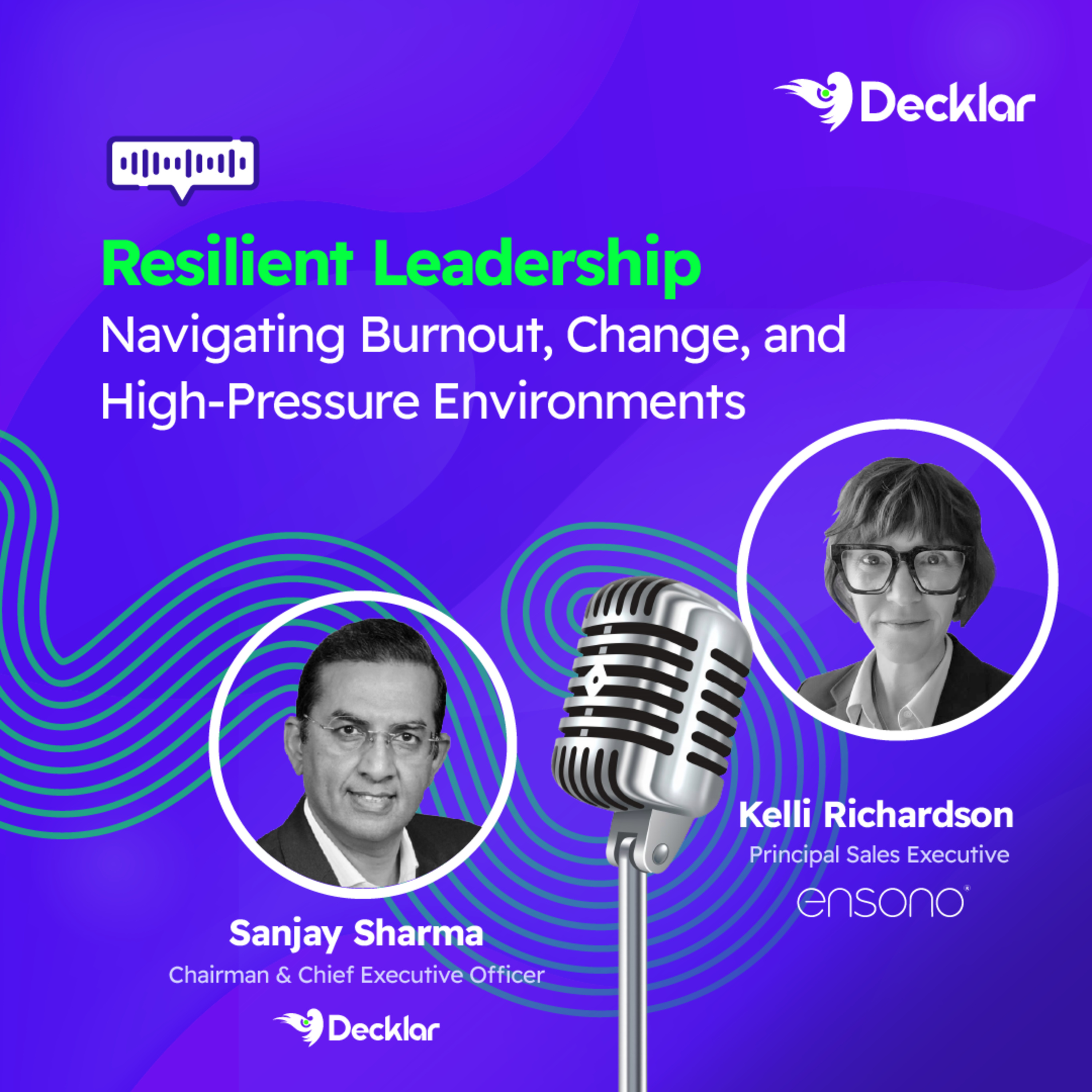 EP43 | Resilient Leadership: Navigating Burnout, Change, and High-Pressure Environments ft. Ensono43 / 100
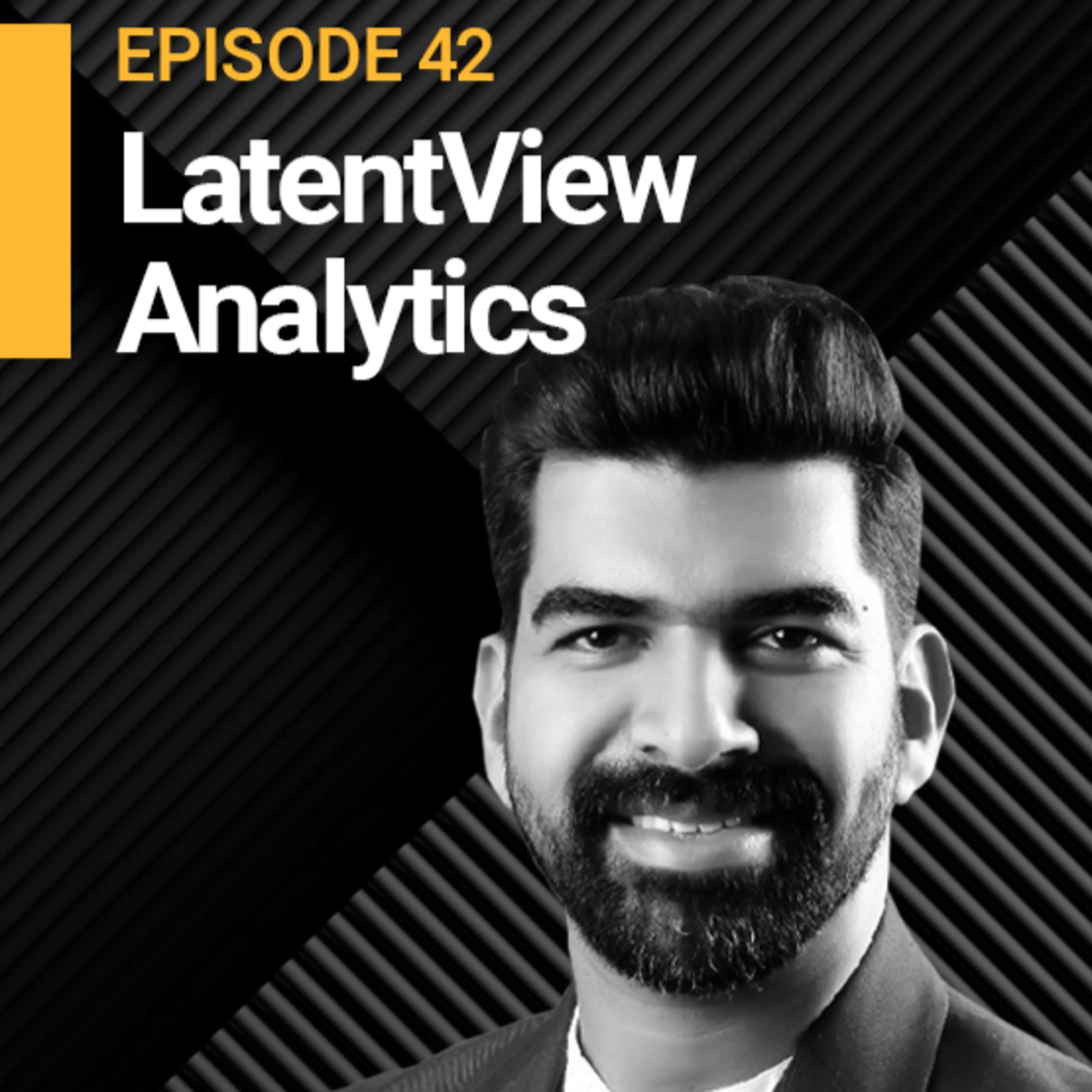 EP42 | Navigating the Fourth Inflection Point in Supply Chain Management ft. LatentView Analytics
 EP41 | How LAPD Recovered $1.13M Stolen Goods in Under 7 Minutes Using the Roambee BeeLabel ft. APL Logistics (KWE Group)
 EP39 | AI, RPA, ML & QC: Supply Chain Impact Simplified ft. Daytona
 EP38 | The AI Paradox in Supply Chain Optimisation ft. Braskem